Travel Inspiration: Google Street View Mashups
There are a lot of places on the web that can inspire you to travel. Pinterest is one that immediately comes to mind, as does Trip Advisor and Facebook. Then you have the myriad of different travel blogs, social media profiles on Twitter, Youtube videos, and articles that are posted in ezines and online versions of popular publications. You can find yourself overwhelmed by the amount of choice you have for holiday ideas.
Well, I am now going to add one more. Because something that the above options don't have is a peek into the cities themselves. Like street views, checking out neighborhoods and just getting the general idea of the layout of a place. Anyone who has ever gone backpacking in an unfamiliar place knows that this can be very important to know before you go. Even more crucial since so many travel sites focus on tourist-based or high priced areas. Those of us who prefer the unbeaten path need to find different information.
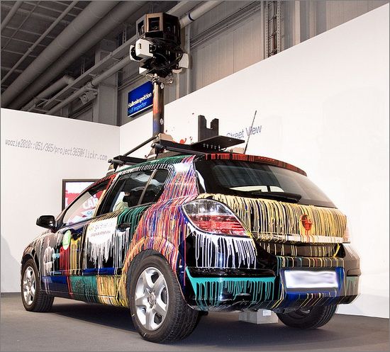
You can find this info using Google Street View. The satellite imaging application is an easy way to find specific areas, look at how the city really is, and decide if you want to go there or not. Lately, I have seen some really cool ways that people are further creating travel inspiring images using Google Street View.
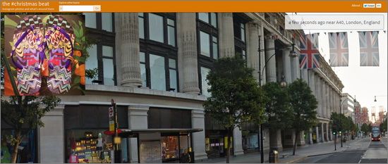
One is through the Rutger's University social media and image project, The Beat. This mashes together images of people and events, along with images from Google Street View set at the location the other image was taken.
For example, there was a photo shown of a children's choir in Florida preparing to sing. They were wearing orange shirts and Santa hats, their choir teacher standing in front of them with his hands raised to begin the song. This was set against an image view of the street it was happening on, along with the address and how long ago it was taken.
Along the bottom of the screen are different hashtags that relate to the image, or just the general tone of it. So if a restaurant chooses to use the project to show a customer enjoying a meal, along with a Street View of their eatery, they could have hashtags about the restaurant and connecting to their Twitter profile beneath.
The images are constantly changing, giving you just enough time to learn more if you choose. Conceptually, it is a really cool idea. The images are fascinating, giving you both an inside and outside look simultaneously. It is always fun when there is a more humanized element, as well. Not to mention, the Street View images are interactive, so you can drag it to get a better look at another portion of the picture.
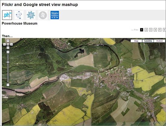
Another cool project is this one by Paul Hagon. It takes historic images and puts them against a map. When you select a photo from the map, it will bring it up and then put it against the Google Street View image today.
While the idea is very simple, it is so cool to see the changes that have occurred over the last several generations. Some comparisons are more drastic than others, and all are interesting.
Conclusion
Both of these projects gives me a different kind of inspiration. The first provides a direct look into what is happening in areas around the US right now. That has always given me a hunger for seeing my own country, and I am planning a road trip for the Spring based on some of the areas I have seen. It will be an attempt to see what my own homeland has to offer.
The second has made me really want to see Australia, and various historical areas around Sydney in particular. Just to see for myself the way that the area has grown and changed over time.
Do you know of any applications or projects that use Google Street View? How do they inspire you to travel? Let us know in the comments.
Guest Author: Annie is an active blogger who loves all things travel. She writes for Dobovo, the free tool to search for Kiev apartments online.


